This series of gold targets, five in number, were discovered at Slieve Glah in County Cavan, following a detailed soil sampling programme. They lie approximately 30km (20 mile) to the southwest of the Clontibret Gold target. These gold targets each extend to 3 km in length and appear to be associated with a major geological structure; the Orlock Bridge Fault.
The targets occur as a series of right angle zones adjacent to the Orlock Bridge Fault. This is a major sinistral fault believed to be an influencing factor on mineralisation in the region. In the Slieve Glah area the Orlock Bridge Fault undergoes a marked swing from its normal northeast - southwest strike, producing a dilatational zone allowing greater permeation and circulation of mineralising fluids, which also may assist in concentration of mineralisation and thus can be associated with substantial accumulations of minerals.
The presence of the nearby Crossdoney copper and molybdenum-bearing granodiorite, known as the ‘Crossdoney Granite’, provides the basis for an exploration model for the area with potential for significant gold deposits.
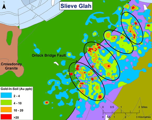
Simplified geology of the target with the Crossdoney Granite to the west of the target soil anomaly
Slieve Glah is regarded as a large and promising target area at a very early stage.
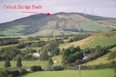
Photograph of the Orlock Bridge Fault in Slieve Glah